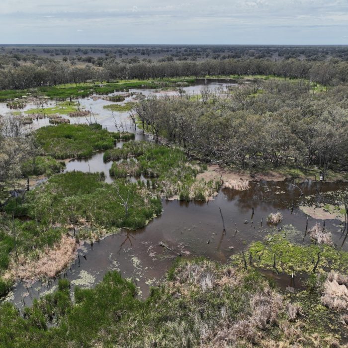
Macquarie River and Marshes Flow-MER
The Centre for Ecosystem Science undertakes monitoring, evaluation and research (MER) on behalf of the Commonwealth Environmental Water Holder (CEWH) in the Macquarie River system including the internationally significant, Ramsar-protected Macquarie Marshes.

About the Macquarie River and Marshes
The Macquarie River and Marshes Flow-MER Area incorporates critical wetland and river assets including the Macquarie Marshes, one of the largest and most important wetlands in the Murray–Darling Basin, extending over 200,000 hectares, approximately 19,000 hectares of which are Ramsar-listed.
New to the Commonwealth Environmental Water Holder’s (CEWH) Flow-MER program in 2024, the Macquarie River and Marshes Area extends downstream of Lake Burrendong, to the junction of the Barwon–Darling River system. It includes the mainstem Wambuul/Macquarie River including all creeks and rivers through the Macquarie Marshes and adjacent wetlands and floodplain.
The system relies on natural flooding and water from various sources including environmental water holdings, unregulated flows and local rainfall. Much of the flow in the Macquarie River is maintained by Burrendong and Windamere dam releases.

Research themes
Our monitoring, evaluation and research (MER) in the Macquarie River and Marshes informs the following themes:
Native vegetation
Our native vegetation studies in the Macquarie River and Marshes aim to understand how water for the environment contributes to water-dependent vegetation communities by maintaining and/or improving diverse vegetation; the extent and condition of woody and non-woody vegetation; and the condition of lignum shrublands.
Study methods include field quadrats and transects, satellite imagery and some drone imagery.
In 2024–2025 we are focused on selecting field and research sites, and vegetation surveys.
Native fish
The Flow-MER native fish work aims to understand how water for the environment contributes to population structure, abundance, diversity, recruitment and condition.
Sampling is conducted annually in Autumn at 20 sample sites along the Wambuul/Macquarie River and Marshes. Electrofishing and fyke netting (to collect freshwater catfish) are used for sampling.
In 2024–2025, key activities are fish community sampling and monitoring, monitoring of Murray cod and golden perch stocking outcomes, and water quality measurements. Fish movement research is also being undertaken.
Acoustic tags have been implanted into golden perch to extend previous research and utilise an existing acoustic telemetry network. Learn more about the acoustic tagging.
Waterbirds
Our waterbird studies aim to understand how water for the environment contributes to abundance and species diversity; breeding occurrences; and providing and supporting habitats.
The team undertake four sets of repeat ground-based field surveys at 10 sites annually and annual Spring aerial and ground surveys. Acoustic recorders monitor the presence of waterbird species outside of specific surveys.
Work in 2024-2025, the project’s first year, is focused on field surveys and installing water depth loggers and acoustic recorders.
River flows and connectivity
Our river flow and connectivity studies aim to understand how water for the environment influences flows, hydrological connectivity, and biotic indicators (eg. waterbirds and fish).
The team use a range of data sources including satellite imagery to capture inundation; existing river gauges to capture flows; and water depth loggers.
In 2024–2025 we are establishing a data archive and setting up the technology infrastructure and software resources required to manage and analyse satellite imagery, inundation models, and gauge and logger data.
Cultural outcomes
The Wayilwan people led by Danielle Flakelar are the cultural advisors for the Macquarie River and Marshes Area Flow-MER program. They support relationship building between Aboriginal People with connection to Country and UNSW staff. Cultural advisors work with Aboriginal People with connection to Country to:
- Facilitate knowledge sharing between Aboriginal People, and between Aboriginal People and UNSW staff
- Identify opportunities and activities to support the values and aspirations of Aboriginal People
- Facilitate opportunities for Aboriginal People to be involved in the design and implementation of Flow-MER projects and activities.
In working together, UNSW supports the protection of Indigenous Cultural and Intellectual Property (ICIP) and Indigenous Data Sovereignty rights as appropriate for the Aboriginal People we work with.
