- UNSW
- ...
- Centre for Ecosystem Science
- Our research
- Rivers and wetlands
- Eastern Australian waterbird survey
- 2022 Eastern Australian Waterbird Survey
- Day 11, Broken Hill to Griffith
- Home
- About us
-
Our research
- Atmospheric
-
Conservation practice
- Water Information System for the Environment (WISE)
- Red list of ecosystems
- Shrub encroachment as a legacy of native mammal decline
- Foraging and habitat ecology of the yellow-tailed black-cockatoo
- Tackling prey naïveté in Australia’s threatened mammals
- Biodiversity sampling in Strzelecki Regional Reserve
- The reintroduction of locally extinct mammals: The landscape ecosystem approach
- The persistence of common wombats in road impacted environments
- Temperate highland peat swamps on sandstone
- Cumberland plain woodland restoration
- Strategic adaptive management
- Limit to climate change adaption in floodplain wetlands - Macquarie Marshes
- Managing for ecosystem change in the greater blue mountains world heritage area
- Adaptive management of Ramsar Wetlands
- Managing for biodiversity in boom and bust cycle environments
- Submission on Biodiversity Act Review
- Marine ecosystems
-
Remote sensing and GIS
- Mangrove response to climatic variability
- Using radar satellite imagery to detect and monitor flooding in arid Australian wetlands
- Supporting continental retrieval of vegetation biophysical attributes
- The Injune Landscape Collaborative Project
- Tree species shifts in response to environmental change
- Regrowth mapping
- Regional biodiversity responses to climate change
- Will climate change affect the ecology of temporary lakes in Australia?
-
Rivers and wetlands
- Changes to the Darling River and Menindee Lakes – past, present and future
- Lowbidgee wetlands of the Murray-Darling Basin - The Nimmie-Caira
- A stitch in time – synergistic impacts to platypus metapopulation extinction risk
- Tube fishway project
- National waterbird survey
- Eastern Australian waterbird survey
- Feather map of Australia
- Life history and dynamics of a platypus (Ornithorhynchus anatinus) population: four decades of mark-recapture surveys
- Adequacy of environmental assessment of the proposed Macquarie River pipeline to the city of Orange
- Increasing production from inland aquaculture in Papua New Guinea for food and income security
- Aquaculture and environmental planning group
- Understanding soil-related constraints on aquaculture production in the highlands of Papua New Guinea
- Improving technologies for inland aquaculture in Papua New Guinea (ACIAR Project FIS2014062)
- Drying of ancient Thirlmere Lakes caused by human activities
- Application of GIS and remote sensing to assess sustainable mariculture and protect conservation zones
- Improving the sustainability of rice-shrimp farming systems in the Mekong Delta, Vietnam
- A SWOT analysis of Papua New Guinea’s inland fisheries and aquaculture sectors
- Carbon and floodplain biota in the Macquarie marshes
- Micro-invertebrate community dynamics and flooding in the Macquarie marshes
- Just add water? The effectiveness of environmental flows during wetland vegetation restoration
- Application of motion sensing cameras as a tool for monitoring riparian fauna
- Captive or wild?
- Brolga and Sarus crane diet comparison
- Lake Brewster pelican banding
- Aquatic invertebrate strategies for coping with drought
- Submission on Draft Lake Eyre Basin Strategic Plan
- The Menindee Lakes Water Savings Project – an example of poor decision-making
- Flow-MER
-
Terrestrial ecosystems
- Post-fire recovery of threatened ecological communities
- Environment Recovery Project: Australian bushfires
- Community stability of upland swamp vegetation
- An innovative approach to maximising catchment water yield in a changing climate
- Post-fire seed production in Hakea Gibbosa
- Managing fire regimes with thresholds to save threatened flora and fauna
- Stopping the toad
- Trophic cascades in NSW North Coast forests
- Individual hunting behavior in feral cats
- Mallee Ecosystem Dynamics
- Investigating artificial waterhole utilisation and management in north-eastern Botswana
- Investigating the spatial ecology, habitat use, behaviour, and ecosystem engineering of hippopotamus (Hippopotamus amphibius), a keystone species in the Okavango Delta and Chobe River, northern Botswana
- Does overgrazing reduce ecosystem functions
-
Study with us
- Courses
-
Postgraduate research projects
- Platypus breeding
- Maximising establishment success in reintroduced populations
- PhD scholarship saving our species - patch value, viability and resilience
- PhD scholarship – mechanics of species irruptions
- Conservation ecology of Greater bilby: survival, reproductive success and movement ecology in a breeding sanctuary in NSW
- Scientia PhD scholarship - Identifying healthy burning practices for Australia’s threatened plant species
- Scientia PhD scholarship - Ecosystem restoration through rewilding
- Platypus population health and dynamics
- Tackling prey naiveté in Australia’s endangered mammals
- Testate amoebae: a new biomarker of climate change and human impact in peatlands
- Surface water dynamics as a function of climate and river flow data
- Multisensor integration for environmental flows
- Response of northern Australian mangroves to climatic variability
- Comparative effects of extreme heat on threatened desert mammals
- Alumni - Where are they now?
- FAQ
- Workshops
- Our Impact
- News
- Wild Deserts
- Flow-MER
- Home
- About us
-
Our research
Conservation practice
- Water Information System for the Environment (WISE)
- Red list of ecosystems
- Shrub encroachment as a legacy of native mammal decline
- Foraging and habitat ecology of the yellow-tailed black-cockatoo
- Tackling prey naïveté in Australia’s threatened mammals
- Biodiversity sampling in Strzelecki Regional Reserve
- The reintroduction of locally extinct mammals: The landscape ecosystem approach
- The persistence of common wombats in road impacted environments
- Temperate highland peat swamps on sandstone
- Cumberland plain woodland restoration
- Strategic adaptive management
- Limit to climate change adaption in floodplain wetlands - Macquarie Marshes
- Managing for ecosystem change in the greater blue mountains world heritage area
- Adaptive management of Ramsar Wetlands
- Managing for biodiversity in boom and bust cycle environments
- Submission on Biodiversity Act Review
Remote sensing and GIS
- Mangrove response to climatic variability
- Using radar satellite imagery to detect and monitor flooding in arid Australian wetlands
- Supporting continental retrieval of vegetation biophysical attributes
- The Injune Landscape Collaborative Project
- Tree species shifts in response to environmental change
- Regrowth mapping
- Regional biodiversity responses to climate change
- Will climate change affect the ecology of temporary lakes in Australia?
Rivers and wetlands
- Changes to the Darling River and Menindee Lakes – past, present and future
- Lowbidgee wetlands of the Murray-Darling Basin - The Nimmie-Caira
- A stitch in time – synergistic impacts to platypus metapopulation extinction risk
- Tube fishway project
- National waterbird survey
- Eastern Australian waterbird survey
- Feather map of Australia
- Life history and dynamics of a platypus (Ornithorhynchus anatinus) population: four decades of mark-recapture surveys
- Adequacy of environmental assessment of the proposed Macquarie River pipeline to the city of Orange
- Increasing production from inland aquaculture in Papua New Guinea for food and income security
- Aquaculture and environmental planning group
- Understanding soil-related constraints on aquaculture production in the highlands of Papua New Guinea
- Improving technologies for inland aquaculture in Papua New Guinea (ACIAR Project FIS2014062)
- Drying of ancient Thirlmere Lakes caused by human activities
- Application of GIS and remote sensing to assess sustainable mariculture and protect conservation zones
- Improving the sustainability of rice-shrimp farming systems in the Mekong Delta, Vietnam
- A SWOT analysis of Papua New Guinea’s inland fisheries and aquaculture sectors
- Carbon and floodplain biota in the Macquarie marshes
- Micro-invertebrate community dynamics and flooding in the Macquarie marshes
- Just add water? The effectiveness of environmental flows during wetland vegetation restoration
- Application of motion sensing cameras as a tool for monitoring riparian fauna
- Captive or wild?
- Brolga and Sarus crane diet comparison
- Lake Brewster pelican banding
- Aquatic invertebrate strategies for coping with drought
- Submission on Draft Lake Eyre Basin Strategic Plan
- The Menindee Lakes Water Savings Project – an example of poor decision-making
- Flow-MER
Terrestrial ecosystems
- Post-fire recovery of threatened ecological communities
- Environment Recovery Project: Australian bushfires
- Community stability of upland swamp vegetation
- An innovative approach to maximising catchment water yield in a changing climate
- Post-fire seed production in Hakea Gibbosa
- Managing fire regimes with thresholds to save threatened flora and fauna
- Stopping the toad
- Trophic cascades in NSW North Coast forests
- Individual hunting behavior in feral cats
- Mallee Ecosystem Dynamics
- Investigating artificial waterhole utilisation and management in north-eastern Botswana
- Investigating the spatial ecology, habitat use, behaviour, and ecosystem engineering of hippopotamus (Hippopotamus amphibius), a keystone species in the Okavango Delta and Chobe River, northern Botswana
- Does overgrazing reduce ecosystem functions
-
Study with us
Postgraduate research projects
- Platypus breeding
- Maximising establishment success in reintroduced populations
- PhD scholarship saving our species - patch value, viability and resilience
- PhD scholarship – mechanics of species irruptions
- Conservation ecology of Greater bilby: survival, reproductive success and movement ecology in a breeding sanctuary in NSW
- Scientia PhD scholarship - Identifying healthy burning practices for Australia’s threatened plant species
- Scientia PhD scholarship - Ecosystem restoration through rewilding
- Platypus population health and dynamics
- Tackling prey naiveté in Australia’s endangered mammals
- Testate amoebae: a new biomarker of climate change and human impact in peatlands
- Surface water dynamics as a function of climate and river flow data
- Multisensor integration for environmental flows
- Response of northern Australian mangroves to climatic variability
- Comparative effects of extreme heat on threatened desert mammals
- Our Impact
- News
- Wild Deserts
- Flow-MER

Date: Tuesday October 18th 2022
Project: Eastern Australian Waterbird Survey
Observers: John Porter & Terry Korn
Pilot: Alex Katopodis
Heavy cloud and rain greeted us the next morning as we fired up the aircraft engine and headed back to Menindee Lakes and Talywalka Creek to complete our surveys.
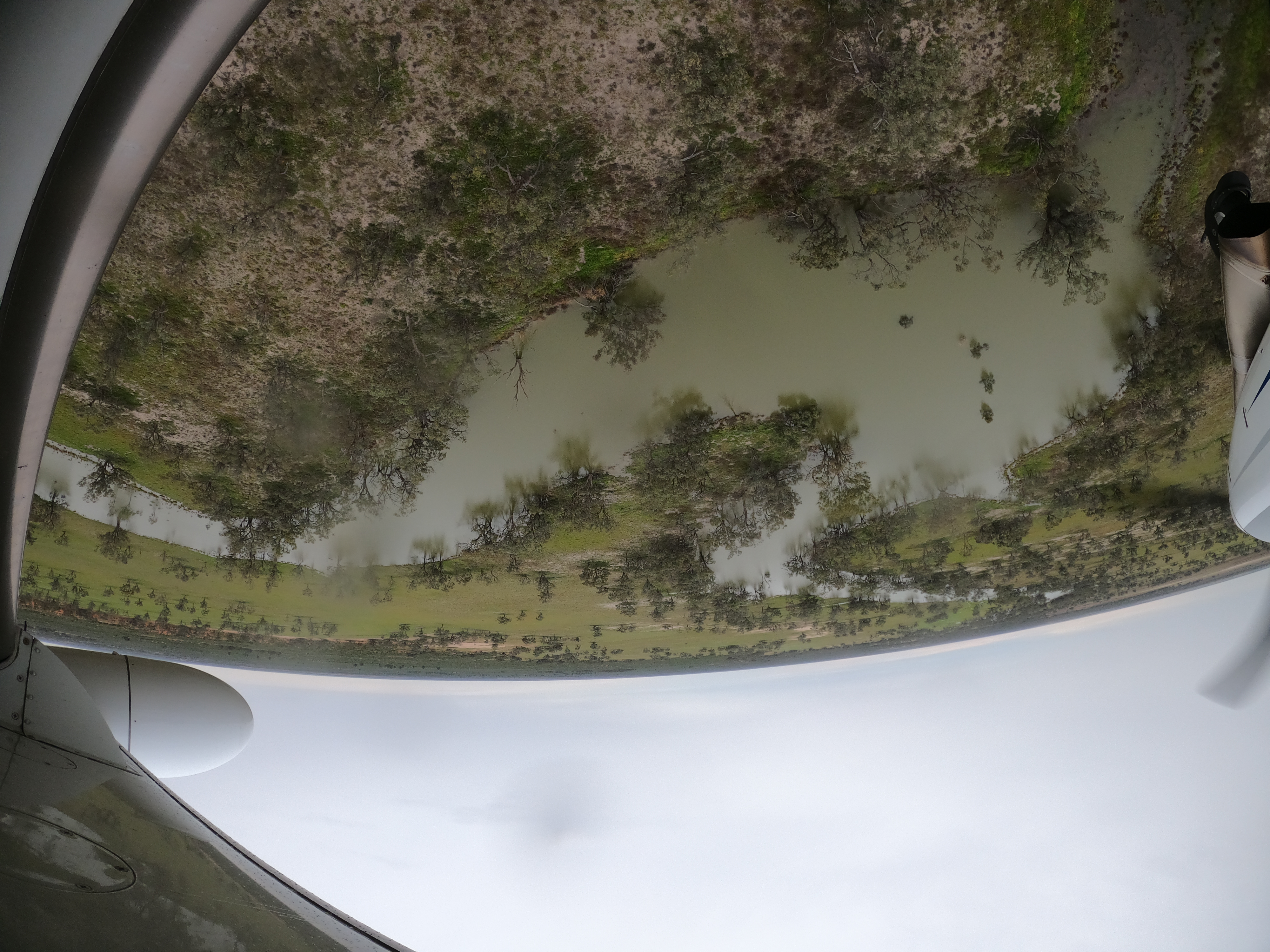
Talywalka Creek meander.
The NPWS quarters and shearing shed on Kinchega NP were ringed with water – a beautiful sight.
Shearing shed and quarters at Kinchega National Park surrounded by floodwater.
Temporary wetlands Emu Lake and Kangaroo Lake were full, but supported only low numbers of waterbirds.
As expected Lake Tandou was dry and devoid of birdlife - its water supply has been so modified it no longer receives water or functions as a wetland even in a flood year. The last wetland on our schedule, Nettlegoe Lake was dry and we departed Band 4 and set our sights on The Darling Anabranch lakes 75 km to the south.
Lake Nettlegoe, dry, even in a flood year.
The Anabranch Lakes system was near full with the intriguingly named Lakes Popiltah, Popio, and Mindona all filled with water though supporting relatively low numbers of waterbirds. Once these lakes were surveyed we continued south to Mildura before turning east along Survey Band 3.
After a quick refuel in Mildura, we headed off again to survey across sections of the Murray with enormous volumes of water flowing in the channel and parts of the floodplain.
The Lowbidgee wetlands looked stunning with water everywhere, healthy red gum forest and some large breeding colonies of straw necked ibis, spoonbills and pelicans.
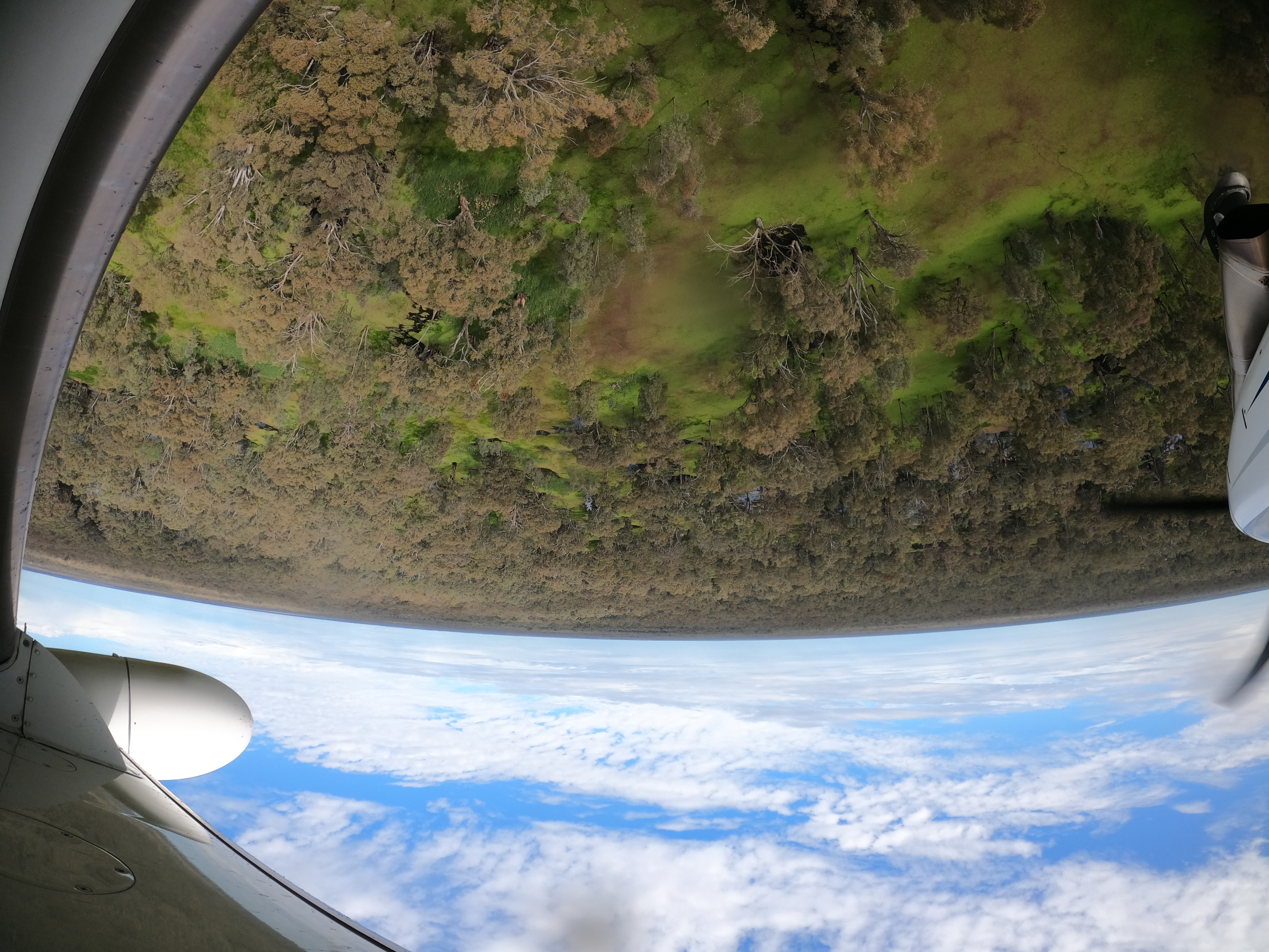
Healthy looking Lowbidgee floodplain.
Yanga Lake, Lowbidgee.
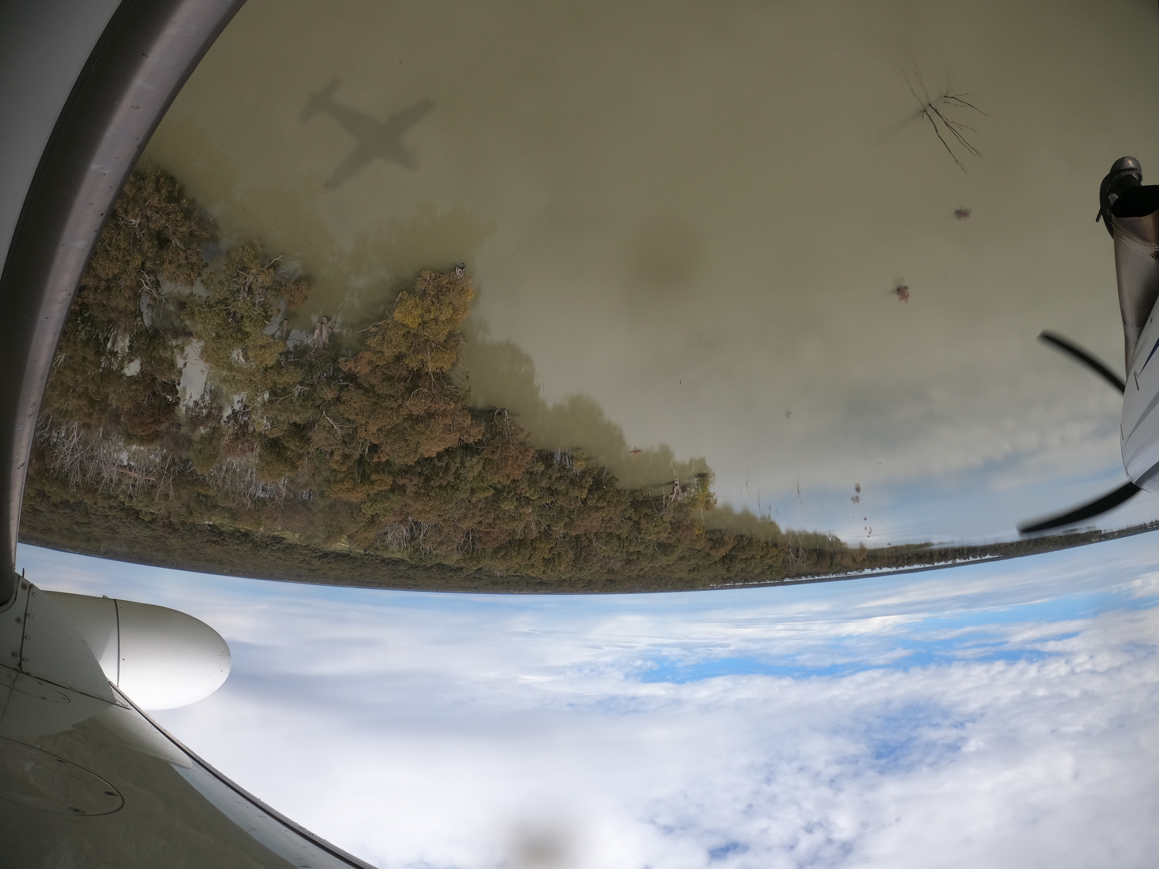
The pelican colony on Kieta Lake, which is a part of the Gayini Wetlands, had around 3,000 nests with most of the birds sitting on eggs.
Survey of Kieta Lake.
Another Gayini wetland, Eulimbah, had a spectacular breeding colony of between 10,000 & 15,000 straw necked ibis in full swing.
Surveying Eulimbah wetland.
We finished up counting and headed to Griffith as the light began to fade, collecting another big day of counting in the bag.