Date: Wednesday, November 5, 2014
Project: Eastern Australian Waterbird Survey
Observer: Richard Kingsford
Start of our flight down the River Murray – Albury to the Murray Mouth. We picked up this mighty river just east of Albury where the main channel winds through a floodplain dotted with small billabongs. The river was running a ‘banker’ to deliver water for irrigated crops downstream. When it is running fast, as it was today, there is little of interest in the main channel for waterbirds because they use the ‘slack’ waters that rest and allow plants, invertebrates and fish to thrive.
The river is flanked by irrigated crops and pastures up in this top end. The water in this river is controlled or regulated, after it is captured first by the large dams of Dartmouth on the Kiewa River and Hume on the Murray.
Photo 1. Crops along the River Murray, east of Albury.
As we fly east along its meandering course, we count waterbirds on Lake Mulwala, the large lake created by a weir that allows water to be diverted down Mulwala canal for irrigation to the north. This small dam is home to cormorants, pelicans, a few ibis and the odd black duck. The deep water is not particularly conducive to high wetland productivity.
Photo 2. Dam wall on Lake Mulwala, allowing water to be diverted down Mulwala canal to the north.
Next survey wetland was the Barmah-Millewa Forest, a massive river red gum forest which stretches out on either side of the channel as we fly down. The main channel has a snake-like form through this forest until it breaks south and we see the main waterbird habitats of swamps and lakes on either side, including Reedy Swamp and Barmah and Moira Lakes. There is little water in any of these swamps but still about 100 white ibis are nesting and there are plenty of spoonbills and pelicans on the shallow waters of the system. I was expecting to see more waterbirds here, given the dryness of surrounding areas.
Photo 3. Swamps in the Barmah-Millewa Forest where there many spoonbills feeding in the shallow water
Photo 4. Barmah Lake has a mixture of open water and Moira grass beds.
The next major wetland downstream is the Koondrook-Perricoota Forest, another huge river red gum forest. We fly down the main channel and then return to fly some of the flooded forest on the eastern boundary. The blackwater is indicative of tannins leaching out from the trees but here we see a few waterbirds. They are scattered throughout the forest wherever there is water but particularly concentrate in the open water areas.
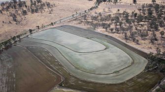
The country becomes progressively drier as we head downstream. Here the water is used to grow rice along parts of the river.
Photo 5. Different shades of brown and green where shallow water is used for rice growing.
The Hattah-Kulkyne lakes were a great surprise. I had expected them to be dry but they were the fullest I had seen them on our surveys of more than five years and brimming with waterbirds. There were pink-eared ducks, hardhead, pelicans, ibis, herons and lots of great cormorants which were breeding in quite a few places. The water has brought considerable productivity to this wetland system. We finish by surveying a small stretch of the Murray River, south of Mildura. As with other parts of the main channel, further upstream, this is not good habitat for waterbirds.
Photo 6. One of the lakes of the Hattah-Kulkyne system where there was water throughout, joining up the lakes that are usually isolated.
